Digital Agriculture: Precision from Space
Harnessing the power of NASA and Copernicus satellite constellations to empower farmers with actionable insights for soil health and yield optimization.
The Technology
Seeing the Invisible
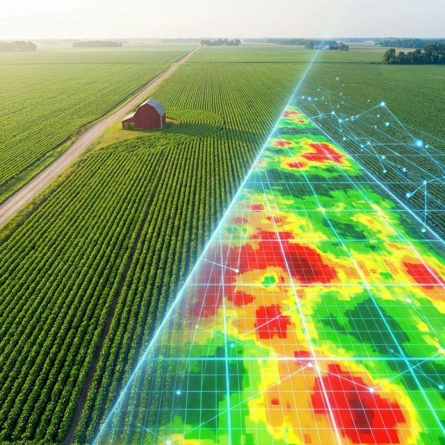
Modern agriculture is data-driven. By utilising advanced sensors on ESA and NASA satellites in low Earth orbit, we can detect plant stress, moisture levels, and growth patterns invisible to the naked eye. We leverage data from the world's most advanced Earth Observation missions.
Sentinel-1 (Radar)
All-Weather Monitoring
C-band Synthetic Aperture Radar (SAR) allows us to see through clouds and rain, day or night.
- Precise Soil Moisture mapping
- Crop structure & biomass analysis
- Flood & waterlogging detection
Sentinel-2 (Optical)
Vegetation Health
Multispectral Imaging with 13 bands, including specialized "Red Edge" bands critical for plant analysis.
- NDVI & Chlorophyll monitoring
- Early pest & disease detection
- Variable Rate Application maps
Landsat 8 & 9
Thermal Insights
Thermal Infrared Sensors (TIRS) measure land surface temperature, a key indicator of crop water stress.
- Evapotranspiration measurement
- Irrigation management & efficiency
- Long-term historical analysis (50+ years)
From Space to Soil: Practical Farming Impact
This is not just data for research; it is actionable intelligence for the farm. By integrating NASA and Copernicus data, we help farmers make informed decisions that directly impact their bottom line.
Reduced Inputs: Apply fertilizers and pesticides only where needed, reducing cost and environmental impact.
Smart Irrigation: Use thermal data to identify exactly when and where crops need water, conserving precious resources.
Soil Health: Monitor long-term trends in soil moisture and organic matter to ensure sustainable land use for generations.
Yield Optimization
Data-driven decisions lead to higher efficiency